
Strengthen of Link Road (4 Lane) from Dhaka Trunk Road to Baizid Bostami Road including Design of Loop Road along AUW – Design Phase
Strengthen of Link Road (4 Lane) from Dhaka Trunk Road to Baizid Bostami Road including Design of Loop Road along the outer Periphery of AUW’s land at Chittagong. Length of Road: 6.00 km, Width: 14.60m. Bridges include: 2x42m PSC, 12m RCC, 22m RCC, 20m RCC. Services include traffic survey and forecast, topographic survey, soil investigation, detailed design and drawings. Funded by Government of Bangladesh (GOB).
Dhaka–Baizid Bostami Link & AUW Loop Road Project

Chittagong, the port city of Bangladesh, is the 2nd largest city of the country with an estimated population of over 4 million which is increasing every year. Since the independence in 1971, there has been all-round development in all spheres of the city. To cope with the rapid development and expansion of the city, the Govt. of Bangladesh has created the Chittagong Development Authority as an autonomous body for the planned development of the city and its neighborhood. The CDA has already drawn up Chittagong Metropolitan Master Plan for the development of the whole city. But due to accelerated development in all sectors, the traffic and transportation system of the city is squeezing day by day for its rapid urbanization and commercial activities. Chittagong being a port city is facing tremendous pressure on its communication system as foreign and domestic freights; both are transported through this port as well as the Central Business District. Chittagong now requires defined network of primary (or arterial) and distributary roads. The primary network is particularly important which reflects the routes which will cater to the needs of the most important longer distance traffic movements. The strategic highways network identifies the major traffic routes, including links that carry significant number of large trucks and those linking major industrial and commercial development and centres of population. With a view of establishing an efficient road network in Chittagong city a metropolitan Master Plan was prepared by UNDP under project BGD/88/052. In the project a link road from Dhaka Trunk Road to Baizid Bostami road has been proposed. Detailed Description of Actual Services provided by your staff: The Consultancy Services to be rendered by the Consultant included: Construction Supervision Services: This phase is 24 months. The services in this phase are generally i) Full time construction supervision and quality control of works ii) Transfer of Technology iii) Monitor progress and prepare progress reports
Barayerhat–Ramgarh Road Widening Project (R-151 & R-152)
The Government of Bangladesh (GOB) has decided for widening the Barayerhat-Heanko-Ramgarh Road (R-151 & R-152) from 5.50m to 11.30m, construction of 9 (nine) bridges and several culverts thereon with the fund jointly invested by the GOB and the Indian Government (Line of Credit III). The length of the road is 38.00 KM starts from Barayerhat, Mirsharai, Chattogram and ends at Ramgarh, Khagrachari. The GOB has allocated public funds for engaging a consulting firm for Review of Pavement, Bridge, Culvert Design and Supervision of highway Construction works (Length 38.00 Km.) under Chattogram Road Division. The main objective of the consulting assignment is to: (i) Review of Pavement Design & Preparation and review of Bridge/Culvert Design. (ii) Ensure Quality and Quantity of Works. (iii) Comprehensive supervision of project implementation activities carried out by the contractor(s) to ensure complete compliance with the drawings, technical specifications, and various stipulations in the contract documents. (iv) Examine Interim Payment Certificate and BoQ of Work done. (v) Provide comments and engineering solutions regarding the problem originated during construction period. (vi) Monitor safeguards implementation includes health and safety activities associated with the project. (vii) Other services as per instruction of the employer. The Project will include rehabilitation of Barayerhat-Heanko-Ramgarh Road (R-151 & R-152) through single package of Civil works contract. The rehabilitation works consist of resurfacing of the existing road with 2.9 meter widening of each side including reconstruction of the critical sections from Barayerhat to Ramgarh to cater to the increased traffic volume and ensure smooth transportation for trade and commerce between India’s North-East and Bangladesh. Accordingly, the consulting services involve Review of Pavement, Bridge, Culvert Design and Supervision of highway Construction works of the project. Detailed Description of Actual Services provided by your staff: The consultant will (i) review the detailed design for the project road already prepared by the RHD and preparation and review of Bridge/Culvert design (ii) provide procurement/ contract related supports, (iii) provide construction supervision to civil works, and (iv) provide other technical support including traffic management and road safety plan upon RHD’s request. In addition to the above services, the consultant will undertake maintenance quality checks for project road about the technical, contractual, and financial aspects of the project implementation.
Rajapara–Payra Port 4-Lane Road Project

Narrative Description of Project: Bangladesh’s external trade is growing on average at 9.2 percent per annum and by 2020th country’s total annual sea borne trade will be in the range of 75 to 80 million tones and 2.75 million twenty-foot equivalent unit (TEU) containers. These volumes are beyond the capacity of Bangladesh’s existing sea ports at Chittagong and Mongla. In particular, Chittagong presently handles around 92 percent of cargo and by 2020 it will have reached full operating capacity. Even a possible expansion of these two ports will not be sufficient to handle forecasted increases in trade volumes, and over the next decade this shortfall could reach around 50 percent of the country’s capacity needs. Given these constraints, the Government of Bangladesh has determined that the Rabnabad Channel at Kalapara Upazila in Patuakhali District is a naturally suitable place for constructing a seaport. This site has been subsequently named Payra Port. Payra Port is located on the West bank of the Rabnabad Channel, approximately 5 nautical miles upstream from harbour mouth. There are no restrictions regarding length and beam and the site with its outer anchorage can potentially cater to vessels with 14.5 metre draught. Considering the handling of future trade volume and export/import growth, Govt. of the People’s Republic of Bangladesh decided to build a new sea port and an Act was passed on National Parliament on 05 Nov 2013. Honorable Prime Minister inaugurated 3rd sea port at Lalua Union, Kalapara Upazila of Patuakhali district on 19 Nov 2013. Description of Actual Services Provided by your staff in the assignment: The work consists of construction supervision of RCC Road, Bridge/Culvert and related structures in accordance with the highest standards of the engineering profession and the applicable standards of PPA. The Consultant will render services under the terms of reference (ToR) but not limited to the following: i) Review road and structural design ii) Site Supervision and witness of Testing and Commissioning iii) Project Management The detailed scope of works is described below: i) Review sub-soil investigation report and other related data ii) Review road and structural design iii) Construction supervision of RCC Road, Structures and other related Structures iv) Project Management and Contract Administration v) Arrange monthly meeting
Sylhet–Tamabil–Jaflong 4-Lane Highway Project (N2)

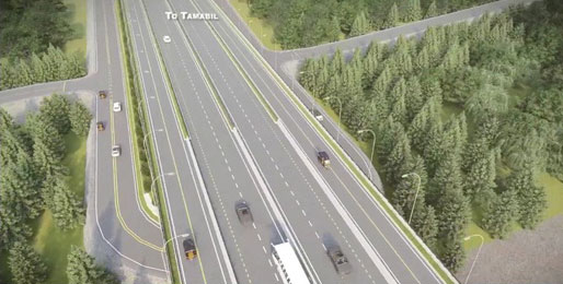
Narrative description of Project: The Design Review Consultant (DRC) has reviewed the Detailed Design of Sylhet-Tamabil Road which was done under Technical Assistance for Sub-Regional Road Transport Project Preparatory Facility (TA-SRTPPF) by finalizing the following tasks: Task-1: Review and update the Feasibility /other studies and procurement documents for the Sylhet Tamabil Road Section.Task-2: Complete review of the Design (including revisiting the designs of high embankment sections, soft grounds, drainage, crossing bazar, villages and road cuts). Review pavement designs considering large number of heavy trucks and proposing PMB in top bituminous layer (wearing course and base course) with detailed specification and methodology. Task- 3: Design of toll plaza. Key features of the project are given below: § Total Road length 56.1km, divided 4 lane road with service lane both sides, main carriageway lane Width 7.3m, service lane Width 5.5m § Toll Plaza No.: 2; 10 lane central toll and 6 lane Surma bridge toll § Box Culverts: 48, under pass: 2, Junction: 7, Bazar Area 9, FOB: 17 Three types of Bridges, Type A, B and C with top width respectively 15.3m, 30.6m and 7.3m. Type A and Type C are built beside existing bridges and type B are standalone new bridges. Typical Pile dia 1.2m. For 411m Surma bridge 1.5m pile dia used. Total 20 Bridges (13 type A+C and 7 type B), Total bridge length = 2223m.
Cumilla–Brahmanbaria 4-Lane Highway Project (GDP-04)
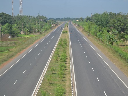
The Government of Bangladesh (GoB) has decided to upgrade the existing Cumilla (Mainamati)-Brahmanbaria (Dharkhar) National Highway (N-102) to a 4-Lane National Highway with safety features including a separate lane for slow-moving vehicular traffic (SMVT) on both sides. thereon with the fund (for civil works) jointly invested by the GoB and the Indian Government (GOILOC03). The length of the road is 54.00 km, starting from Cumilla (Moinamati) and ending at Dharkhar, Brahmanbaria. The GoB has allocated public funds for engaging a consulting firm for the Design Review and updates of Highway, Bridges, Flyover etc., Assisting Procurement Process and Supervision of highway Construction works (Length 54.00 km). The Project will include upgrading of existing Cumilla (Mainamati)-Brahmanbaria (Dharkhar) National Highway (N-102) to a 4-Lane Highway, including service lanes at both sides through two packages of civil works contract. The construction works consist of the upgradation/construction of 54.00 kilometers of four-lane National Highway with international standards, of which 49.53 kilometers flexible pavement, 4.47 kilometers are rigid pavement, 14 nos. Bridges having a length of 1218.44 meters, 01 no. Flyover having length of 1030.224 meters, 02 nos. underpass having length of 20.00 meters, 50 nos. RCC Box culvert has a total length of 396.30 meters, 12 nos. Foot Over Bridges has a length of 438.91 meters and Construction of 680 sq.m. office building etc. The-feasibility study, LA & Resettlement plan, detailed designs have been prepared in 2015 through Technical Assistance for Subregional Road Transport Project Preparatory Facility, implemented by RHO, which requires review. Objectives of the Assignment The main objectives of the Consultancy services are – i. To supervise comprehensively the project implementation activities carried out by the contractor(s) to ensure complete compliance with the drawings, technical specifications, and various stipulations in the contract documents. ii. To supervise & monitor safeguards implementation including health and safety activities associated with the project. iii. To monitor & supervise environmental & social development safeguards associated with the project. iv. Other services as per instruction of the employer. Scope of Services The Consultant will (i) Prepare (if required), review the detailed design for the project road already prepared by the RHD and preparation and review of Flyover, intersection, Bridge/Culvert design, (ii) provide procurement/contract-related supports, (iii) provide construction supervision to civil works, and (iv) provide other technical support including traffic management and road safety plan. In addition to the above services, the Consultant will undertake maintenance quality checks for the project road with regard to the technical, contractual, and financial aspects of the project implementation.